Fullerton, California
Fullerton, California | |
|---|---|
|
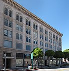
Clockwise from top left: Old City Hall, the Chapman Building, Fullerton Transportation Center, downtown | |
| Motto: "The Education Community"[1] | |
 Location of Fullerton in Orange County, California | |
| Coordinates: 33°52′48″N 117°55′43″W / 33.88000°N 117.92861°W | |
| Country | United States |
| State | California |
| County | Orange |
| Incorporated | February 15, 1904[2] |
| Area | |
| • Total | 22.44 sq mi (58.11 km2) |
| • Land | 22.42 sq mi (58.07 km2) |
| • Water | 0.01 sq mi (0.03 km2) |
| Elevation | 164 ft (50 m) |
| Population | |
| • Total | 143,617 |
| • Rank | 6th in Orange County 41st in California 188th in the United States |
| • Density | 6,411/sq mi (2,475/km2) |
| Demonym | Fullertonian |
| Time zone | UTC−8 (PST) |
| • Summer (DST) | UTC−7 (PDT) |
| ZIP Codes | 92831–92838 |
| Area codes | 562, 657/714 |
| FIPS code | 06-28000 |
| GNIS feature IDs | 1660658, 2410556 |
| Website | www |
Fullerton is a city in northern Orange County, California, United States. As of the 2020 census, 143,617 people lived in Fullerton.[5]
There are a number of major schools in Fullerton. These include Cal State Fullerton, Hope International University, Marshall B. Ketchum University, and Fullerton College (one of California's oldest and most renowned junior colleges).
Originally, Fullerton was an agricultural community. In the early 1900s, the downtown became an urban area. Many of the homes and buildings date from the 1920s, right before the stock market crash that started the Great Depression. After World War II, the city became suburbs of Los Angeles. Fullerton's population peaked in the 2010s and has started to slowly decline.[6]
Fullerton is the birthplace of the electric guitar, first produced by the Fender Musical Instruments Corporation.[7]
Other points of interest include the largest 9/11 memorial outside of the East Coast[8] and the Muckenthaler,[9] an estate now used for performing arts and other events.
The Coyote Hills is a small mountain range running along the north side of the city. Hiking and horseback riding trails cut through those hills.
References
[change | change source]- ↑ "City of Fullerton California". City of Fullerton California. Retrieved September 6, 2012.
- ↑ "California Cities by Incorporation Date". California Association of Local Agency Formation Commissions. Archived from the original (Word) on November 3, 2014. Retrieved August 25, 2014.
- ↑ "2019 U.S. Gazetteer Files". United States Census Bureau. Retrieved July 1, 2020.
- ↑ "Fullerton". Geographic Names Information System. United States Geological Survey. Retrieved November 4, 2014.
- ↑ 5.0 5.1 "Fullerton (city), California". 2020 census. U.S. Census Bureau. Retrieved March 20, 2022.
- ↑ "Fullerton, California Population 2024". worldpopulationreview.com. Retrieved 2024-11-26.
- ↑ "Leo Fender Gallery - Fullerton Museum Center". www.fullertonmuseum.com. Retrieved 2024-11-26.
- ↑ Tour, Jesse La (2019-09-19). "Land of the Free, Home of the Brave". Fullerton Observer. Retrieved 2024-11-26.
- ↑ admin. "The Muckenthaler Cultural Event Center & Wedding Venue in Fullerton". Muckenthaler Mansion. Retrieved 2024-11-26.


