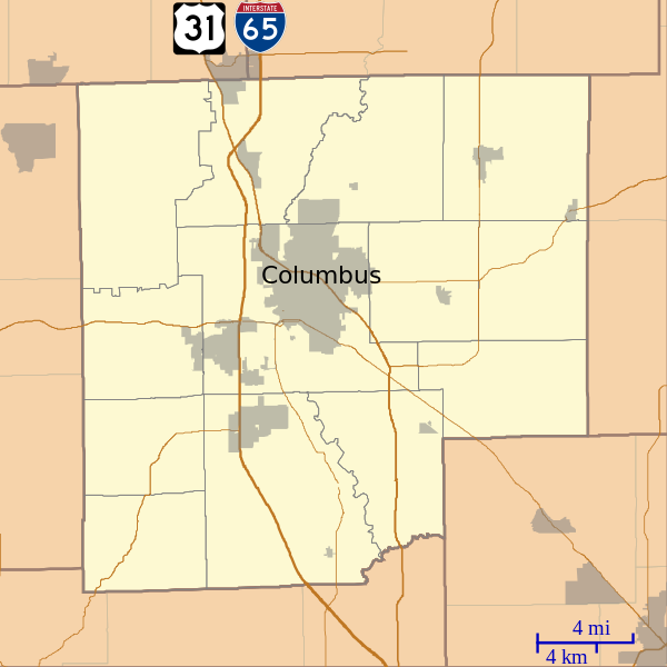
File:Location map of Bartholomew County, Indiana.svg
Appearance

Size of this PNG preview of this SVG file: 600 × 600 pixels. Other resolutions: 240 × 240 pixels | 480 × 480 pixels | 768 × 768 pixels | 1,024 × 1,024 pixels | 2,048 × 2,048 pixels.
Original file (SVG file, nominally 768 × 768 pixels, file size: 192 KB)
File history
Click on a date/time to view the file as it appeared at that time.
| Date/Time | Thumbnail | Dimensions | User | Comment | |
|---|---|---|---|---|---|
| current | 14:26, 15 September 2012 |  | 768 × 768 (192 KB) | Omnedon | == {{int:filedesc}} == {{Information |Description={{en|This is a map of Bartholomew County, Indiana, USA which includes incorporated settlements, township borders, and major highways.}} |Source=My own work, using cust... |
File usage
The following 46 pages use this file:
- Azalia, Indiana
- Bethany, Bartholomew County, Indiana
- Bethel Village, Indiana
- Burnsville, Indiana
- Columbus Historic District (Columbus, Indiana)
- Corn Brook, Indiana
- D. W. Heagy Farm
- David Aikens House
- Elnora Daugherty Farm
- First Baptist Church (Columbus, Indiana)
- First Christian Church (Columbus, Indiana)
- Garden City, Indiana
- Grammer, Indiana
- Grandview Lake, Indiana
- Haw Creek Leather Company
- Hope Historic District (Hope, Indiana)
- Irwin Conference Center
- James Marr Farm
- Jewell Village, Indiana
- Kansas, Indiana
- Mabel McDowell Adult Education Center
- McEwen-Samuels-Marr House
- McKinley School (Columbus, Indiana)
- Miller House (Columbus, Indiana)
- Mount Healthy, Indiana
- New Hope Bridge
- Newbern, Indiana
- Newsom–Marr Farm
- North Christian Church
- North Ogilville, Indiana
- Nortonburg, Indiana
- Ogilville, Indiana
- Old Saint Louis, Indiana
- Petersville, Indiana
- Pugh Ford Bridge
- Rosstown, Indiana
- Rugby, Indiana
- Saint Louis Crossing, Indiana
- Stony Lonesome, Indiana
- The Republic Newspaper Office
- Walesboro, Indiana
- Waymansville, Indiana
- Waynesville, Indiana
- William R. Gant Farm
- Module:Location map/data/USA Indiana Bartholomew County
- Module:Location map/data/USA Indiana Bartholomew County/doc
Global file usage
The following other wikis use this file:
- Usage on ar.wikipedia.org
- Usage on azb.wikipedia.org
- Usage on ceb.wikipedia.org
- Usage on fr.wikipedia.org
- Usage on kn.wikipedia.org
- Usage on si.wikipedia.org
- Usage on tr.wikipedia.org
- Usage on uz.wikipedia.org
- Usage on war.wikipedia.org
