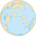
קובץ:World ocean map.gif
מראה
World_ocean_map.gif (500 × 500 פיקסלים, גודל הקובץ: 68 ק"ב, סוג MIME: image/gif, בלולאה, 4 תמונות, 10 שניות)
היסטוריית הקובץ
ניתן ללחוץ על תאריך/שעה כדי לראות את הקובץ כפי שנראה באותו זמן.
| תאריך/שעה | תמונה ממוזערת | ממדים | משתמש | הערה | |
|---|---|---|---|---|---|
| נוכחית | 06:12, 8 באפריל 2007 |  | 500 × 500 (68 ק"ב) | Quizatz Haderach | Animated world ocean map! |
שימוש בקובץ
הדפים הבאים משתמשים בקובץ הזה:
שימוש גלובלי בקובץ
אתרי הוויקי השונים הבאים משתמשים בקובץ זה:
- שימוש באתר ab.wikipedia.org
- שימוש באתר am.wikipedia.org
- שימוש באתר ang.wikipedia.org
- שימוש באתר arc.wikipedia.org
- שימוש באתר ar.wikipedia.org
- שימוש באתר as.wikipedia.org
- שימוש באתר ban.wikipedia.org
- שימוש באתר ba.wikipedia.org
- שימוש באתר bcl.wikipedia.org
- שימוש באתר be-tarask.wikipedia.org
- שימוש באתר bew.wikipedia.org
- שימוש באתר bg.wikipedia.org
- שימוש באתר bi.wikipedia.org
- שימוש באתר bjn.wikipedia.org
- שימוש באתר blk.wikipedia.org
- שימוש באתר bn.wikipedia.org
- שימוש באתר br.wikipedia.org
- שימוש באתר bs.wikipedia.org
- שימוש באתר bxr.wikipedia.org
- שימוש באתר ca.wikipedia.org
- שימוש באתר ce.wikipedia.org
- שימוש באתר ch.wikipedia.org
- שימוש באתר crh.wikipedia.org
- שימוש באתר da.wikipedia.org
- שימוש באתר de.wiktionary.org
- שימוש באתר diq.wikipedia.org
- שימוש באתר dtp.wikipedia.org
- שימוש באתר el.wikipedia.org
- שימוש באתר en.wikipedia.org


