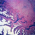
Fichièr:Lombardy.satellite.jpg
Aparença

Talha d'aquesta previsualizacion: 600 × 600 pixèls. Autras resolucions : 240 × 240 pixèls | 480 × 480 pixèls | 768 × 768 pixèls | 1 024 × 1 024 pixèls | 2 048 × 2 048 pixèls | 4 055 × 4 055 pixèls.
Fichièr d'origina (4 055 × 4 055 pixèl, talha del fichièr: 15,2 Mo, tipe MIME: image/jpeg)
Istoric del fichièr
Clicar sus una data e una ora per veire lo fichièr tal coma èra a aqueste moment
| Data e ora | Miniatura | Dimensions | Utilizaire | Comentari | |
|---|---|---|---|---|---|
| actual | 24 julhet de 2023 a 21.18 |  | 4 055×4 055 (15,2 Mo) | Don-vip | |
| 5 agost de 2006 a 19.05 |  | 639×639 (391 Ko) | Lange~commonswiki | {{Information |Description= Several elongated lakes (dark features) are identifiable in this southerly view of the Italian-Swiss border. The elongated lakes are the creation of alpine (or valley) glaciers that moved generally southward through this sectio |
Paginas que contenon lo fichièr
La pagina çaijós compòrta aqueste imatge :
Usatge global del fichièr
Los autres wikis seguents utilizan aqueste imatge :
- Utilizacion sus ar.wikipedia.org
- Utilizacion sus arz.wikipedia.org
- Utilizacion sus ast.wikipedia.org
- Utilizacion sus az.wikipedia.org
- Utilizacion sus be.wikipedia.org
- Utilizacion sus bg.wikipedia.org
- Utilizacion sus ca.wikipedia.org
- Utilizacion sus cy.wikipedia.org
- Utilizacion sus de.wikivoyage.org
- Utilizacion sus diq.wikipedia.org
- Utilizacion sus el.wikipedia.org
- Utilizacion sus fi.wikipedia.org
- Utilizacion sus fr.wikipedia.org
- Utilizacion sus fr.wikivoyage.org
- Utilizacion sus ga.wikipedia.org
- Utilizacion sus gd.wikipedia.org
- Utilizacion sus gl.wikipedia.org
- Utilizacion sus he.wikipedia.org
- Utilizacion sus hy.wikipedia.org
- Utilizacion sus ia.wikipedia.org
- Utilizacion sus id.wikipedia.org
- Utilizacion sus ilo.wikipedia.org
- Utilizacion sus it.wikipedia.org
- Utilizacion sus ka.wikipedia.org
- Utilizacion sus ku.wikipedia.org
- Utilizacion sus la.wikipedia.org
- Utilizacion sus mt.wikipedia.org
- Utilizacion sus mzn.wikipedia.org
- Utilizacion sus nn.wikipedia.org
- Utilizacion sus no.wikipedia.org
- Utilizacion sus pl.wikipedia.org
- Utilizacion sus ro.wikipedia.org
- Utilizacion sus ru.wikipedia.org
- Utilizacion sus ru.wikinews.org
- Utilizacion sus sl.wikipedia.org
- Utilizacion sus sr.wikipedia.org
- Utilizacion sus tt.wikipedia.org
- Utilizacion sus vec.wikipedia.org
- Utilizacion sus vi.wikipedia.org
- Utilizacion sus www.wikidata.org


